D1.1 Technology survey: Prospective and challenges - Revised version (2018)
7 Standards: INSPIRE and OGS
7.1 INSPIRE (INfrastructure for SPatial InfoRmation in Europe)
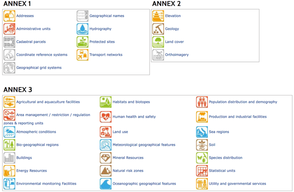
INSPIRE directive is based on the infrastructures for spatial information, which creates Spatial Data Infrastructure (SDI) procedures and methodologies), with key components specified through technical implementing rules, by addressing 34 spatial data themes (see Figure 30). INSPIRE requires the adoption of ‘Implementing Rules’ which set out how the system will operate. INSPIRE regulations require standardized metadata documentation for the data and the services.
INSPIRE provides access to location and properties as well as core vocabularies and unique identifiers for buildings, addresses, transport networks, utility and production facilities and all kinds of geographical, geophysical, statistical and environmental data related to such spatial features covering an area or location.
Figure 30. INSPIRE: 34 spatial data themes.
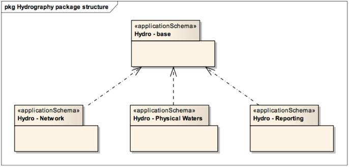
The hydrology applications that use INSPIRE has an internal schema that is divided into three separate application schemas mapped on physical waters (primarily for mapping purposes), network model (primarily for spatial analysis and modelling), management and reporting units. These schemas are defined with dependencies with spatial object types (see Figure 31). In this case, INSPIRE contributes through required publication in portal, access through network services, standardized metadata, up to data information significantly to re-users needs. According with 2015 INSPIRE Conference, it is used for the active dissemination and reporting of information related to legislation on urban waste water.
Figure 31. Package structure of the Hydrography application schemas.
As a general model, the client applications access geospatial data stored in repositories through services in the middleware layer. Although SDI nodes may rely technologically on cyberinfrastructure to provide increased distributed hardware capacity for handling huge datasets, conceptually, the distributed GIS approach to SOA-based applications is perhaps best represented by the SDI paradigm, in which standardized interfaces are the key to allowing geospatial services to communicate with each other in an interoperable manner responding to the true needs of users [Granell, 2010].